
CHAS. S. MIDDLETON AND SON | TECHNOLOGY IN AGRICULTURE
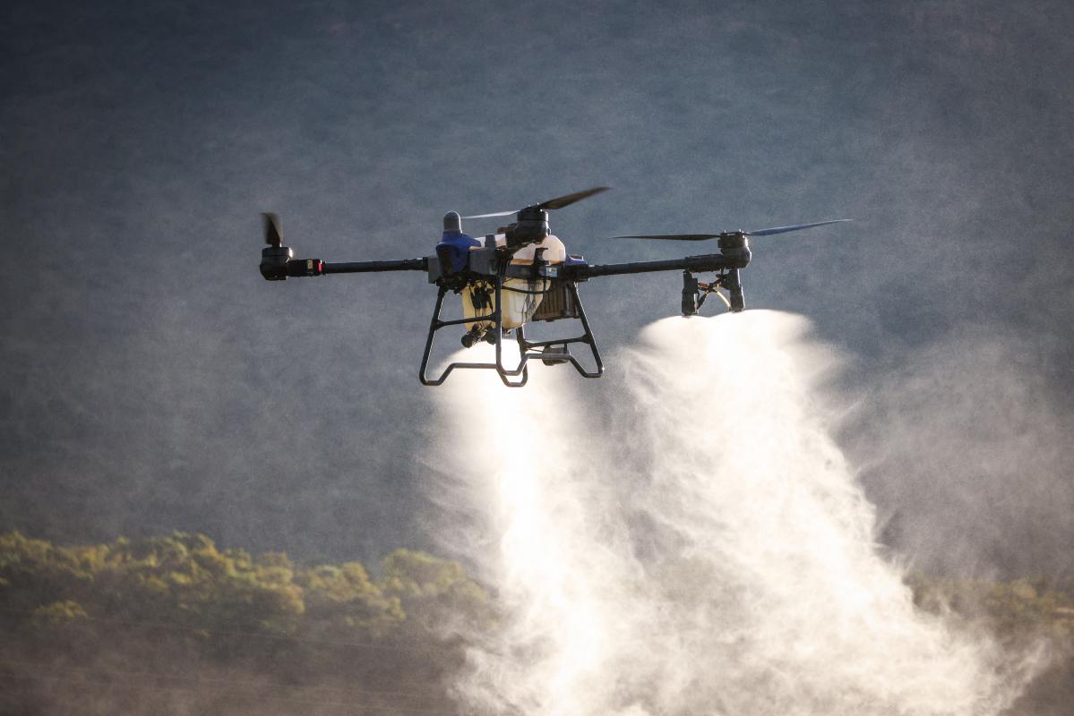
Agricultural drones have evolved far beyond taking aerial photographs. Today, drones are being used to spray crops, monitor livestock, inspect fences, evaluate plant health, map terrain, and help farmers and ranchers manage their operations more efficiently.
What makes this technology particularly interesting is that it is no longer limited to large farming operations. While specialized agricultural drones can perform sophisticated tasks, smaller consumer drones can provide tremendous value to everyday ranchers and landowners.
At Chas. S. Middleton and Son, we are particularly interested in how these advancements may improve the operation, productivity, and long-term value of agricultural properties.
Agricultural Spray Drones: A New Approach to Crop Management


Agricultural spray drones are becoming an increasingly important tool in precision agriculture.
Companies such as DJI and XAG have developed specialized aircraft capable of applying pesticides, herbicides, fertilizers, and other agricultural products.
Unlike conventional ground equipment, spray drones can operate without driving through crops, potentially reducing crop damage and soil compaction.
They may also be useful in fields with difficult terrain, wet ground, or areas that are challenging to access with traditional spraying equipment.
Some advanced systems use automated flight planning, terrain-following capabilities, and precision application controls to improve consistency and efficiency.
However, spray drones are not necessarily replacements for conventional agricultural aircraft or ground sprayers. Their effectiveness depends on field size, application rates, weather conditions, operating costs, and regulatory requirements.
For ranchers, spray drones may also offer a practical option for applying labeled herbicides to unwanted brush and pasture weeds, particularly in rough terrain or areas difficult to reach with ground equipment. Brush control requires matching the treatment to the target species, plant growth stage, and site conditions. Adequate foliage coverage, the label-required spray volume, wind, and drift management all affect whether a drone is suitable for a particular job. Ranchers should work with a qualified applicator and consult extension guidance on aerial brush control before selecting a treatment.
In the United States, ranch and farm flights for work generally fall under FAA Part 107 when the drone weighs less than 55 pounds at takeoff, including its payload. Operations must meet remote-pilot certification, registration, Remote ID, airspace, and flight rules, with any required waivers or authorizations. Agricultural spraying also requires compliance with Part 137, including an Agricultural Aircraft Operator Certificate and applicable exemptions; Part 107 alone does not authorize spraying. Drones weighing 55 pounds or more operate under the applicable Part 91 and Part 137 framework with required FAA exemptions. Applicators must also follow pesticide labels and state licensing and application rules. In Texas, applicable pesticide licenses must include the aerial category, and the product label must permit the aerial application being performed.
See Agricultural Spray Drones in Action
Watch the DJI Agras T50 demonstrate how drone technology is being used for precision crop spraying and field management.
Video: Agri Spray Drones — DJI Agras T50 Full Spraying Demo.
LiDAR: Mapping the Land in Three Dimensions

One of the most exciting developments in drone technology is the use of LiDAR, which stands for Light Detection and Ranging.
LiDAR systems use laser pulses to measure distances and create highly detailed three-dimensional representations of the landscape.
For agricultural properties, this technology can be particularly useful in evaluating:
-
Topography, slopes, and elevation changes.
-
Drainage patterns and potential water development.
-
Erosion, gullies, and terrain conditions.
-
Road and infrastructure planning.
-
Vegetation and certain land-management characteristics.
For ranch brokers, landowners, and prospective buyers, accurate terrain information can provide a much better understanding of a property's physical characteristics.
LiDAR can also be useful when evaluating difficult-to-access terrain or planning improvements on large ranches.
Infrared and Thermal Imaging: Seeing What the Human Eye Cannot
Specialized drones equipped with thermal or multispectral cameras can provide information that ordinary photographs cannot.
Thermal cameras detect differences in surface temperature, which can help operators locate livestock, wildlife, or equipment under certain conditions.
Multispectral cameras measure reflected light in different wavelengths and can help identify variations in crop vigor, vegetation condition, and potential stress.
These technologies may help agricultural producers:
-
Identify crop areas requiring closer inspection.
-
Locate livestock in large pastures.
-
Evaluate vegetation and grazing conditions.
-
Identify irrigation irregularities.
-
Monitor certain infrastructure problems.
Thermal imaging does not diagnose livestock disease by itself, and multispectral imagery generally requires interpretation and field verification. Nevertheless, both technologies can provide valuable information to help producers make better management decisions.
Everyday Ranch Applications: Checking Fences, Water, and Livestock

Perhaps the most practical application of drone technology for many ranch owners is also one of the simplest: using a drone to check on the ranch without having to drive across it.
Consider a rancher who needs to inspect a distant pasture after a storm. Instead of spending considerable time driving rough roads or crossing difficult terrain, a drone may provide a quick aerial view of the area.
Even relatively affordable drones can be useful for:
-
Fence inspections: Identifying damaged fences, fallen trees, or areas needing closer inspection.
-
Livestock checks: Locating cattle and observing herd distribution.
-
Water monitoring: Checking stock tanks, ponds, troughs, and surrounding conditions.
-
Road inspections: Identifying washouts, erosion, or access problems.
-
Wildlife observation: Surveying open areas while minimizing unnecessary disturbance.
-
Property management: Documenting improvements, vegetation changes, and property conditions over time.
For larger ranches, the potential savings in travel time alone can make drone technology worth considering.
A drone cannot replace every physical inspection, but it can help ranchers determine where their attention is most urgently needed.
Autonomous Drones and the Future of Ranch Management
Another emerging development is autonomous drone operation.
Some systems allow drones to operate from automated docking stations, fly predetermined routes, collect photographs or other information, and return for charging.
As the technology continues to advance, these systems could potentially provide more routine monitoring of large agricultural properties.
Imagine a ranch where a drone periodically inspects designated areas, documents water facilities, or collects imagery showing changes in pasture conditions.
Although equipment costs, communications, regulations, and operating requirements remain important considerations, the possibilities are intriguing.
What Does This Mean for Agricultural Real Estate?
At Chas. S. Middleton and Son, we see drone technology as more than another tool for taking attractive property photographs.
Drones are increasingly capable of providing information that helps owners, buyers, and agricultural operators understand and manage land.
Detailed aerial imagery, terrain mapping, vegetation analysis, and infrastructure monitoring can contribute to better-informed decisions.
For prospective buyers, these technologies may help reveal characteristics that are difficult to appreciate during a conventional property inspection.
For landowners, drones may offer opportunities to reduce certain operating expenses, identify maintenance needs, and improve management efficiency.
While drone technology does not automatically increase a property's market value, improvements in productivity, infrastructure management, and operating efficiency can influence how buyers evaluate agricultural land.
The Future of Drones in Agriculture
Agricultural drone technology continues to evolve rapidly.
From large spray drones operating over cropland to smaller aircraft checking cattle and fences, these tools are becoming increasingly relevant to both farming and ranching.
The most significant development may be that advanced aerial technology is becoming accessible to a broader range of agricultural producers.
As these capabilities improve, drones could become as familiar on working ranches as GPS guidance systems, electronic livestock identification, and other technologies that have changed agricultural operations.
At Chas. S. Middleton and Son, we will continue exploring these innovations and how they may influence the management, productivity, and value of agricultural land.
Chas. S. Middleton and Son — We Know Land.