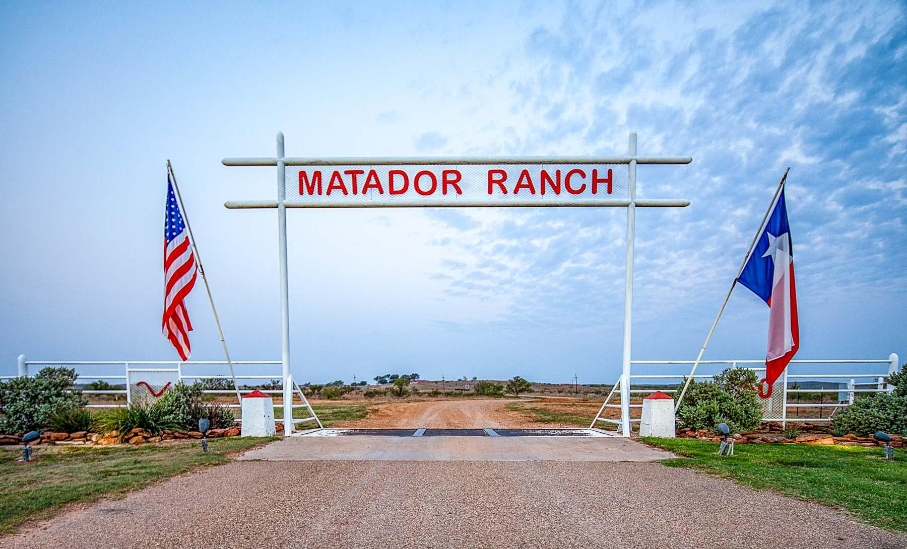
Matador Ranch
$124,450,000 | 131,000.00 ACRES | SOLD
Overview
- Price: $124,450,000
- Acreage: 131,000.00
- ID: 528
- Location: Matador, Texas
- County: Cottle
- Second County: Crosby
- Third County: Floyd
- Status: Sold
THE MATADOR CATTLE COMPANY
131,000 ACRES, MORE OR LESS
MOTLEY, FLOYD, CROSBY, DICKENS, AND COTTLE COUNTIES, TEXAS
Centered around the community of Matador, Texas, the sprawling Matador Ranch is steeped in history and today remains one of the most historic ranches in Texas, along with the King Ranch, Waggoner Ranch, 6666’s Ranch and Pitchfork Ranch.
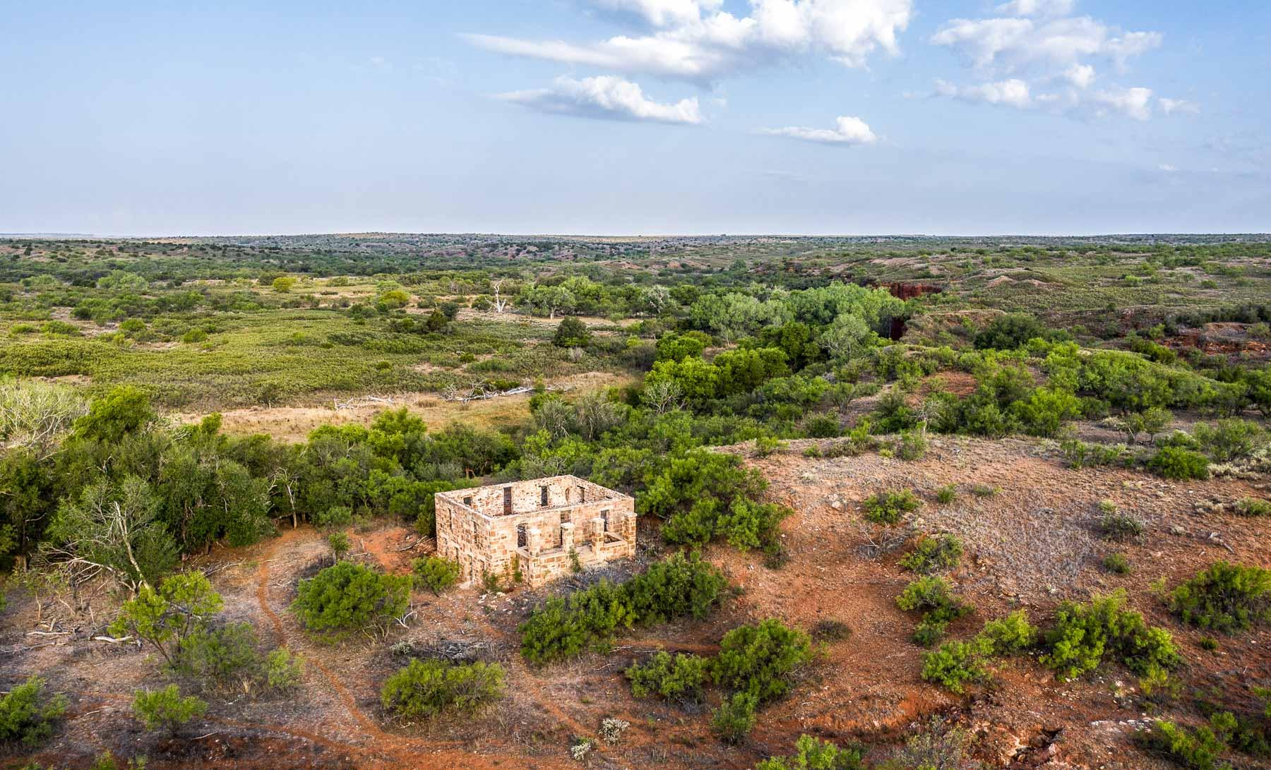
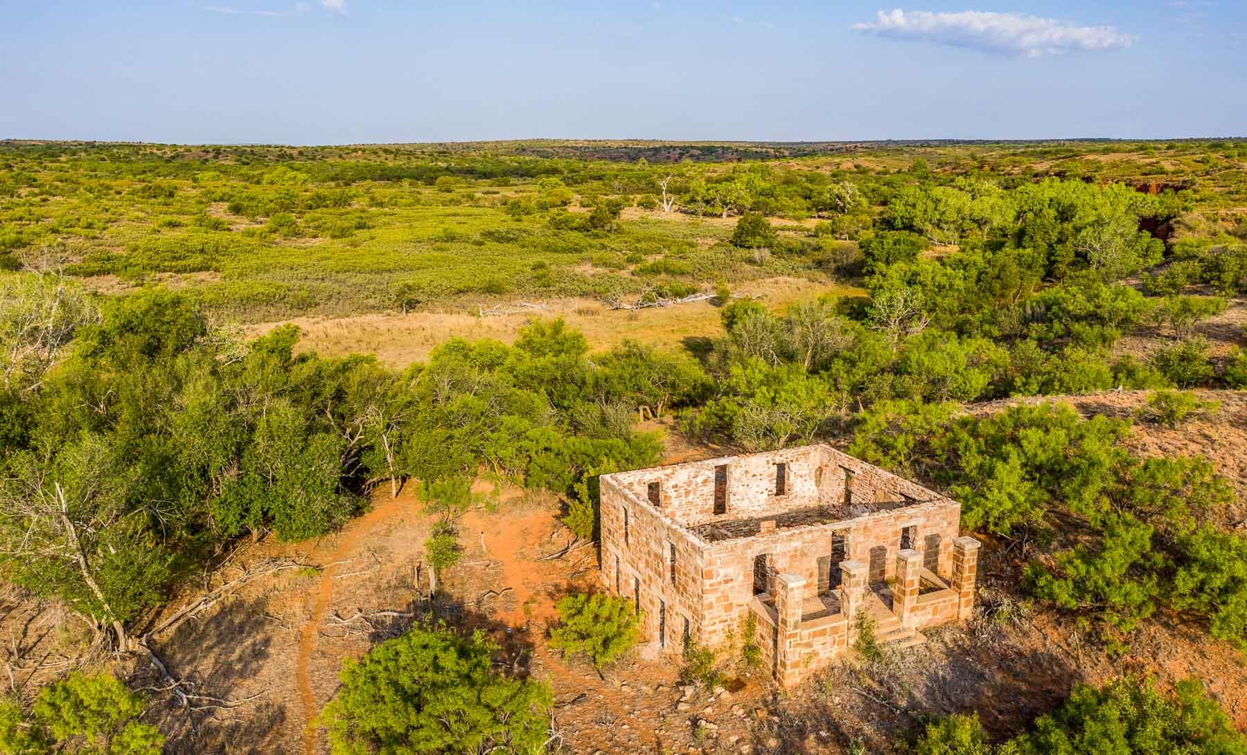
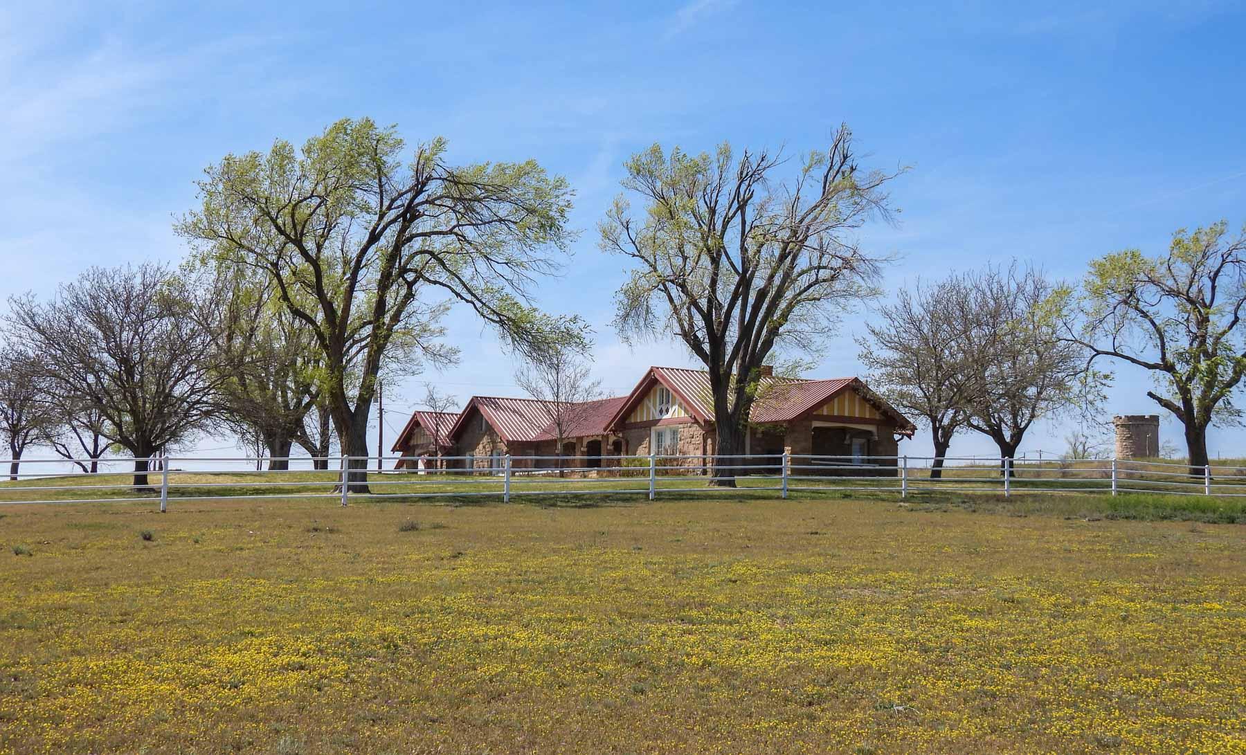
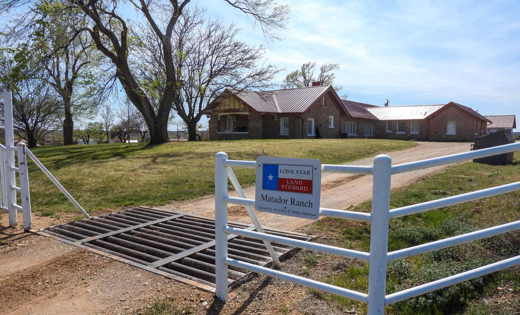
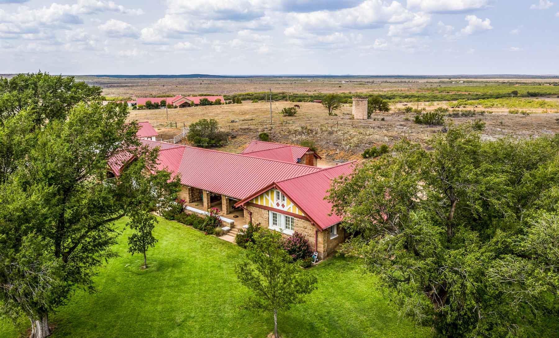
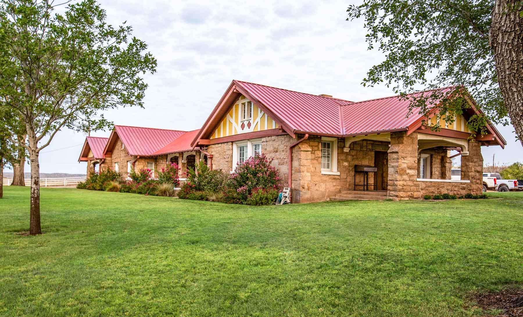
In December 1882, the Matador Land and Cattle Company was formed by a Scottish syndicate, which acquired approximately 1.5 million acres in Motley, Floyd, Crosby, Dickens and Cottle Counties. By 1951, the acreage had been reduced to approximately 800,000 acres, which was sold to Lazard Freres and Company of London. This development company subdivided these massive holdings and in 1952, Fred C. Koch, co-founder of Koch Industries, Inc., purchased the Matador’s Flying V cattle brand and the “50” horse brand, which had been used by the Scots during their 70-year ownership of the Matador Ranch. Simultaneously, Mr. Koch acquired the Matador Ranch Headquarter Division, the Wolf Creek Division, and the Russellville Division, all centered around Matador. In the 1970’s he purchased the Lucky Knob and Tee Pee City Divisions of the Matador. The Matador Headquarters Division features a 7,000 square foot, stone structure headquarters home/office. The exterior stone walls are 24 inches thick and were built from rock quarried from the ranch and hauled to the ranch headquarters. This structure was built in 1917 and is now over 100 years old. This stately stone structure has been well maintained and continues to serve as the home for the general ranch manager and also as the business office. The nearby Matador Cook House was also built in 1917 and is of similar construction.
Since the original 1952 purchase by Mr. Koch, opportunities arose to purchase additional divisions of the Matador Ranch. Today, besides the original Headquarters Division (approximately 36,429 acres), the ranch now comprises the Wolf Creek Division (approximately 21,379 acres) on the southwest side of the ranch, the Tee Pee City/Lucky Knob Division (approximately 41,077 acres), located to the northeast and the Russellville Division (approximately 31,962 acres), positioned southeast of the Headquarters Division, all together totaling approximately 130,846 acres.
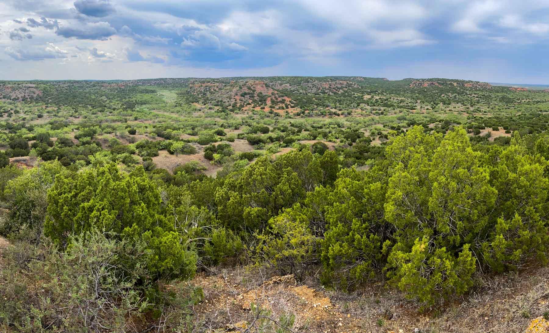
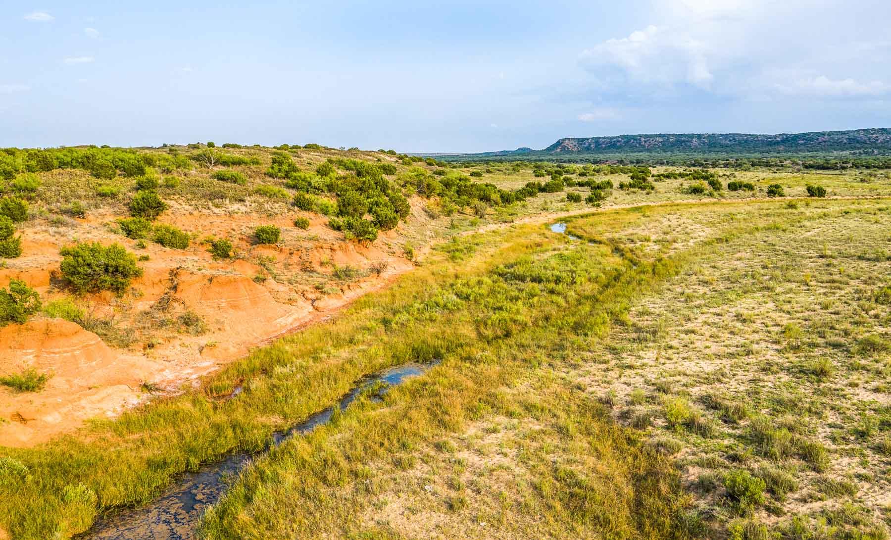
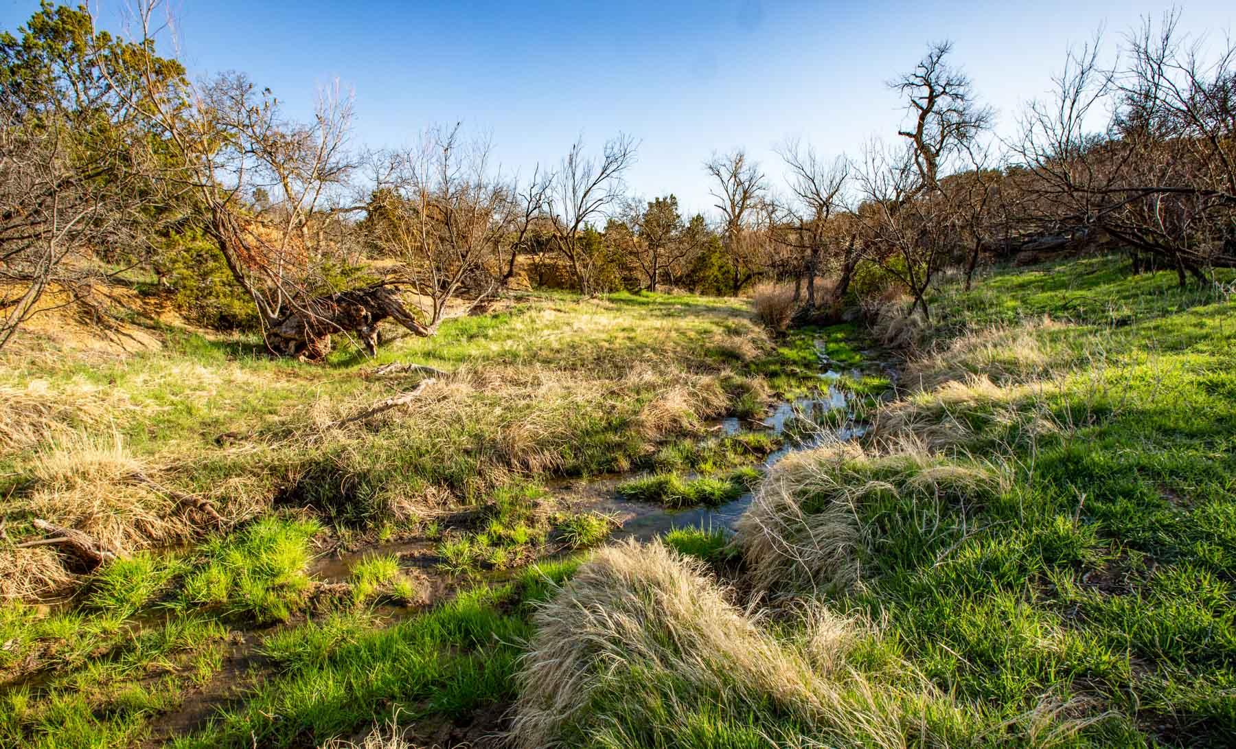
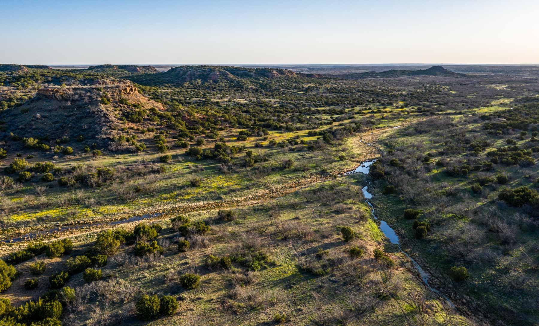
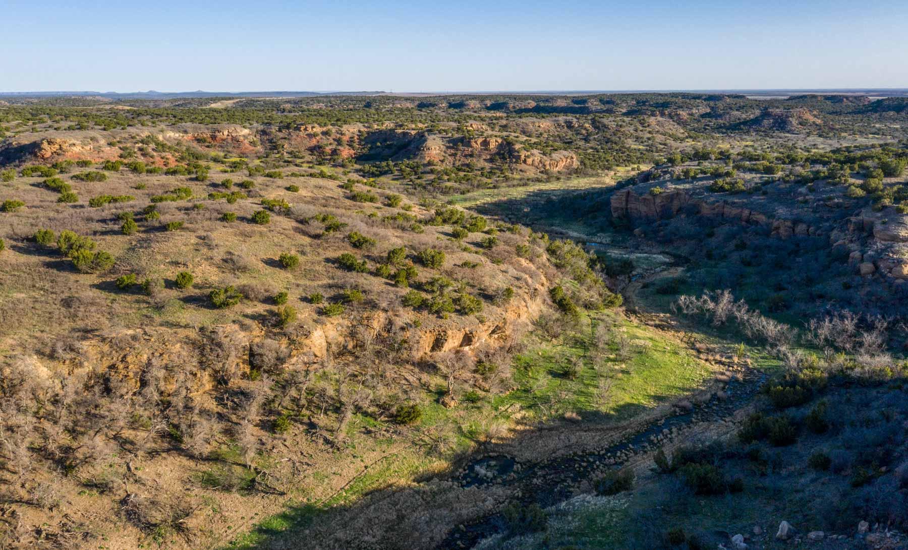
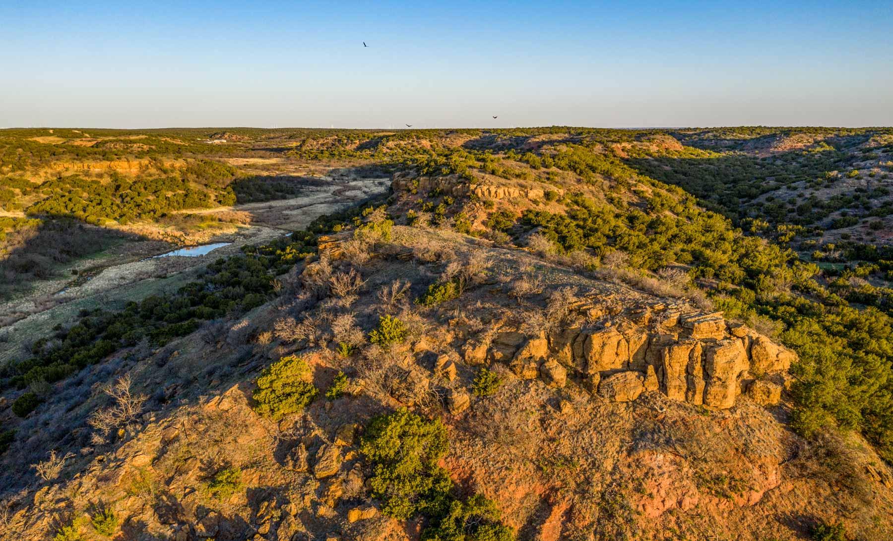
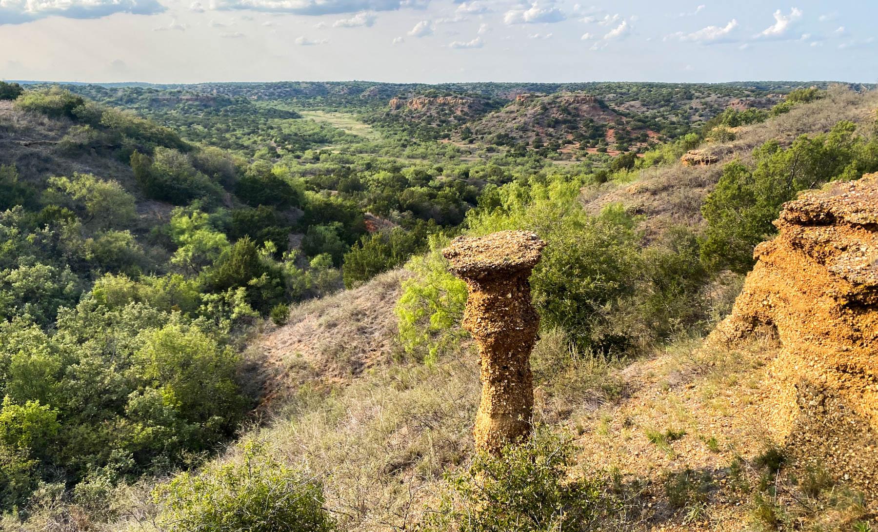
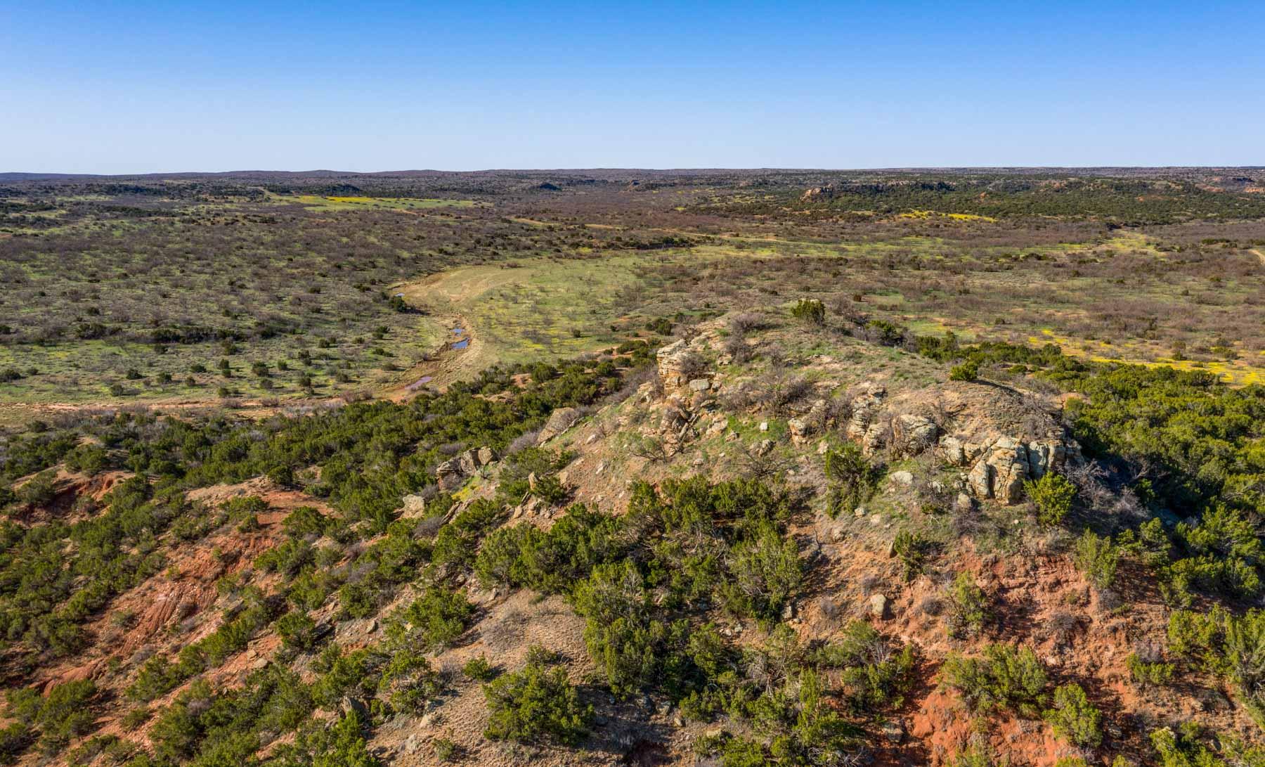
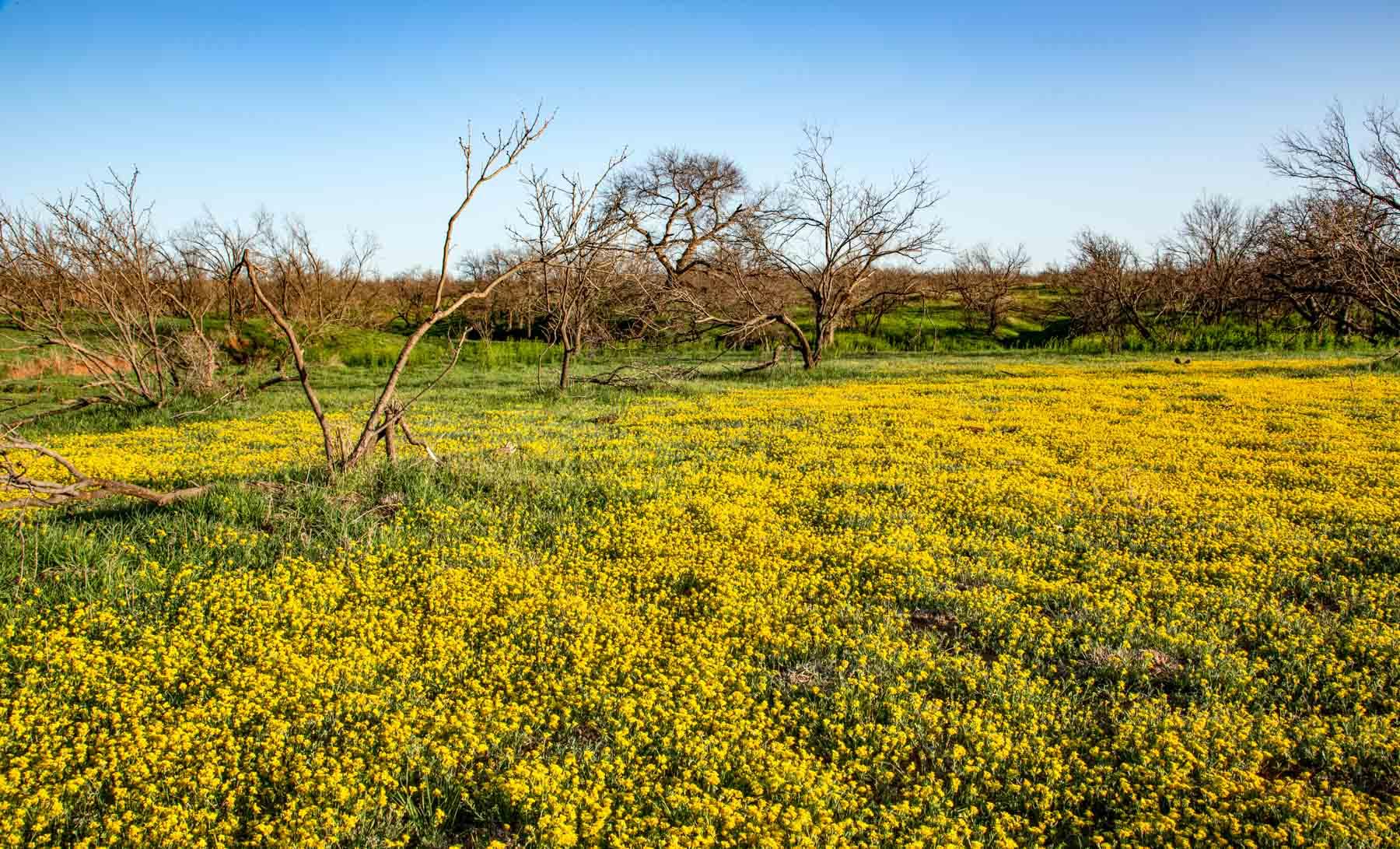
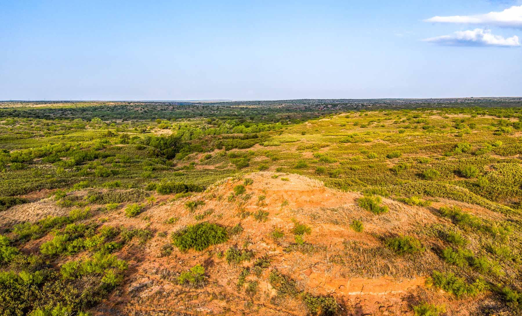
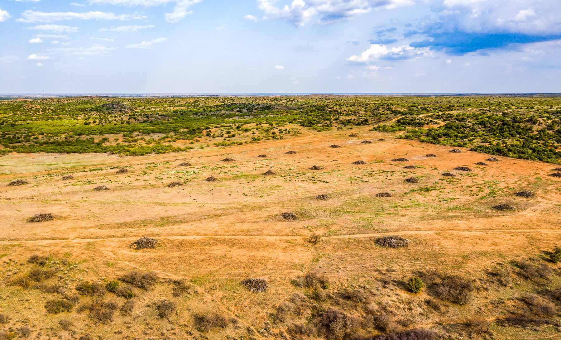
The far western edge of the ranch extends to the level Plains country above the Caprock Escarpment. To the east of the Caprock, the majority of the ranch is identified as being in the Rolling Plains Region of Texas. This portion of the ranch has a hilly and often rolling topography draining to numerous lower creek drainages.
Over the years, the ranch has had an ongoing brush control program, with brush being mechanically eradicated, aerially sprayed, and raked and stacked in some areas. More recently, a new chemical just approved called “Invora” has been applied by aerial application in a thick Mesquite/Juniper bottom area. Initial results indicate a very good kill rate for this new chemical.
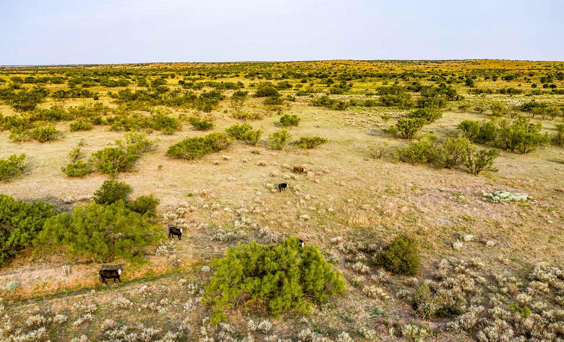
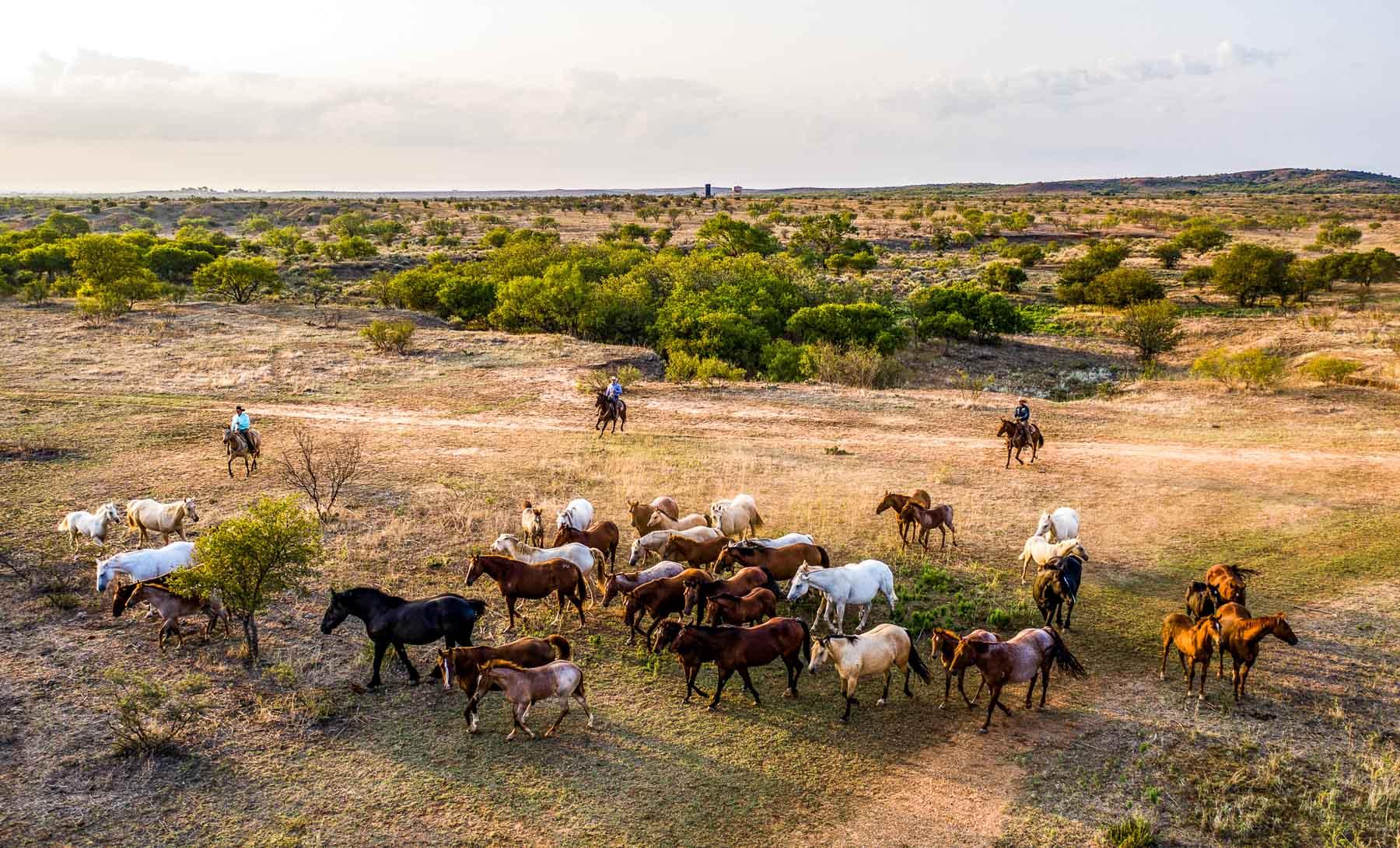
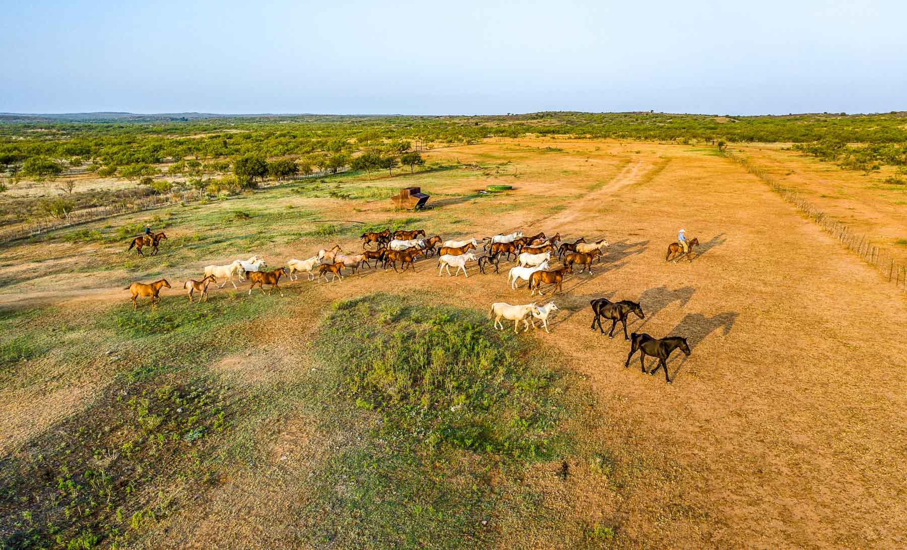
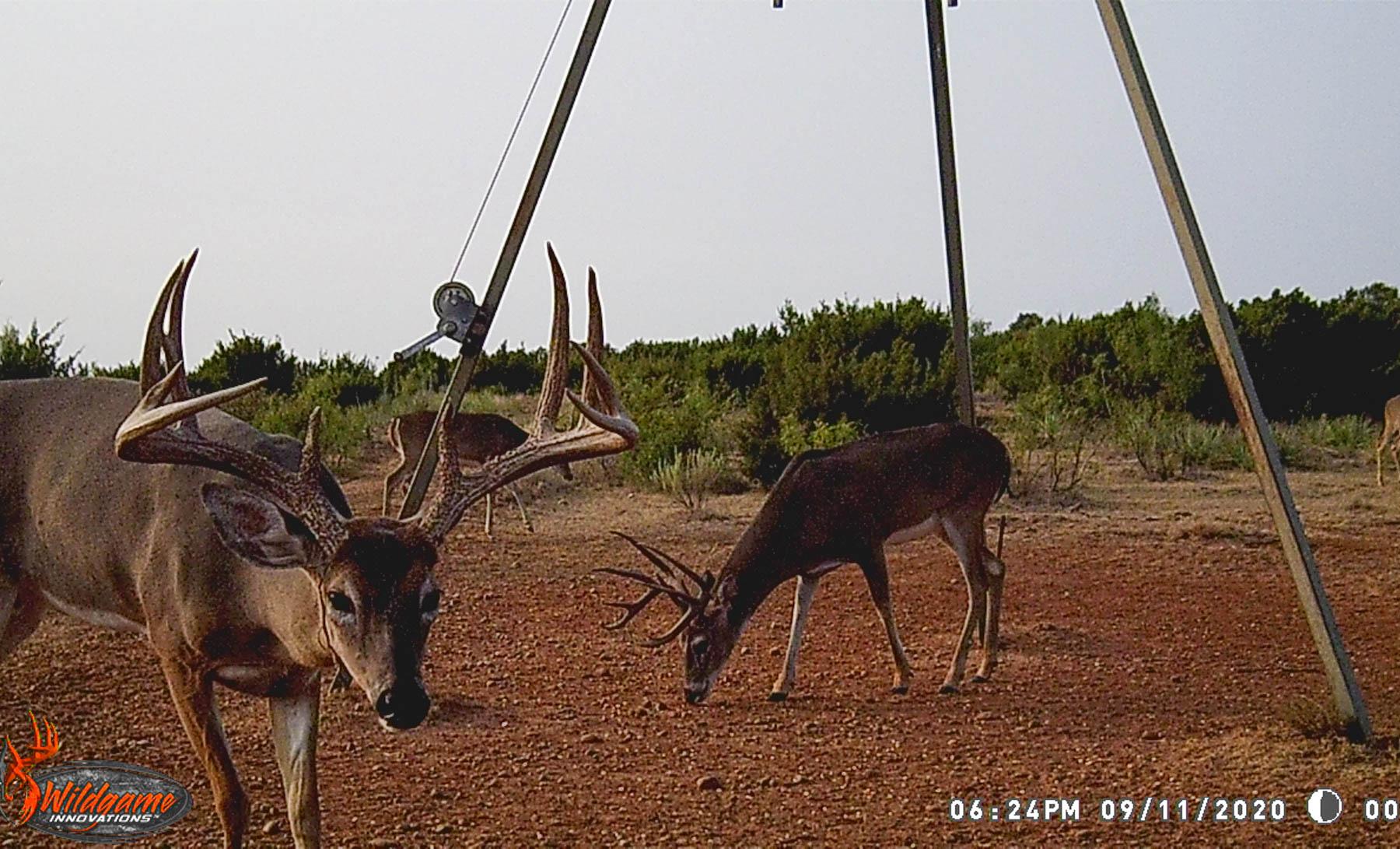
The Matador Ranch is nationally recognized for its quality cattle operation, typically maintaining a commercial cow/calf operation of 3,000 – 3,500 cows, plus 450 - 500 replacement heifers and 180 - 200 bulls. By maintaining a very conservative cow herd of this size, in typical years the ranch can also run 1,200 – 1,500 stocker cattle. The cow herd is a Hereford/Angus cross of Black Baldy Cows, with Charolais, Hereford and Angus Bulls used to produce high demand quality calves. In addition to the cattle operation, the ranch maintains a horse operation consisting of ranch horses for the employees, broodmares and stallions. The ranch maintains around 20 – 25 broodmares and 4 stallions. The horse operation focuses on producing quality ranch horses with outstanding cow sense, good dispositions and the ability to traverse rugged terrain. As a testament to the success of the horse breeding program, in 2013 the Matador Ranch received the Best Remuda Award from the American Quarter Horse Association and AQHA Corporate Partner, Zoetis.
The philosophy of the Koch Family has always been to preserve, improve and protect the land. The excellent ranch management, coupled with outstanding wildlife management, have transformed the Matador Ranch into one of the premier ranches in Texas. Management has focused on land stewardship in the form of invading brush control through mechanical and aerial eradication, along with prescribed burns from time to time used to eliminate invasive plant species. This brush control not only improves and increases livestock grazing, but also provides more desirable habitat for wildlife. Additionally, water features have been improved and added, which helps distribute livestock throughout the ranch for better grazing practices. The Texas Parks and Wildlife Department’s 2010 Lone Star Land Steward Award was awarded to the Matador Ranch recognizing their outstanding land stewardship practices. Other land stewardship honors include:
• 2010 Outstanding Rangeland Stewardship Award from the Texas Section Society for Range Management/Texas and Southwestern Cattle Raisers Association
• 2011 Region 4 Winner in the Environmental Stewardship Award Program sponsored by the Department of Agriculture’s Natural Resources Conservation Service, US Fish and Wildlife, Dow AgroSciences, National Cattlemen’s Foundation, and the National Cattlemen’s Beef Association
• Koch Industries’ 2012 Environmental Health & Safety Excellence Award
• 2019 Beef Quality Assurance Cow/Calf Award
Matador Ranch Description
The Matador Ranch is located approximately 75 miles northeast of Lubbock, Texas and 120 miles southeast of Amarillo. The ranch centers around Matador, Texas, the county seat of Motley County. Nearly all of the ranch is located in Motley County, but the west end of the ranch extends into Floyd County, the southwest corner of the ranch extends into Crosby and Dickens Counties and the far east edge of the property extends into Cottle County. All divisions of the ranch have a combination of paved and graded county road access.
The ranch is located in a desirable ranching area with precipitation averaging 22 – 24 inches per year. Generally, the ranch receives 5 – 6 inches of snow through the winter months. Most of the precipitation occurs in May and June, with July and August being hot and dry. In the fall the ranch generally receives beneficial rains, growing strong grass lasting through the winter months. Most ranchers in this area run a cow/calf operation with supplemental protein feeding through the winter months. The Matador Ranch has a conservative stocking rate so that stocker/yearling cattle can also be run in years of favorable moisture.
Wolf Creek Division
The Wolf Creek Division contains approximately 21,379 acres and is located approximately 6 miles west of the small community of Roaring Springs, or about 10 miles southwest of Matador. Several thousand acres on the extreme west end are located on the level plains above the Caprock Escarpment. Portions of this area were in cultivation at one time, but are now reseeded to improved bluestem pasture. Other areas on the plains remain in native pasture. All of the plains country has an open appearance with very little brush invasion. Elevations on the plains country are approximately 3,000 feet.
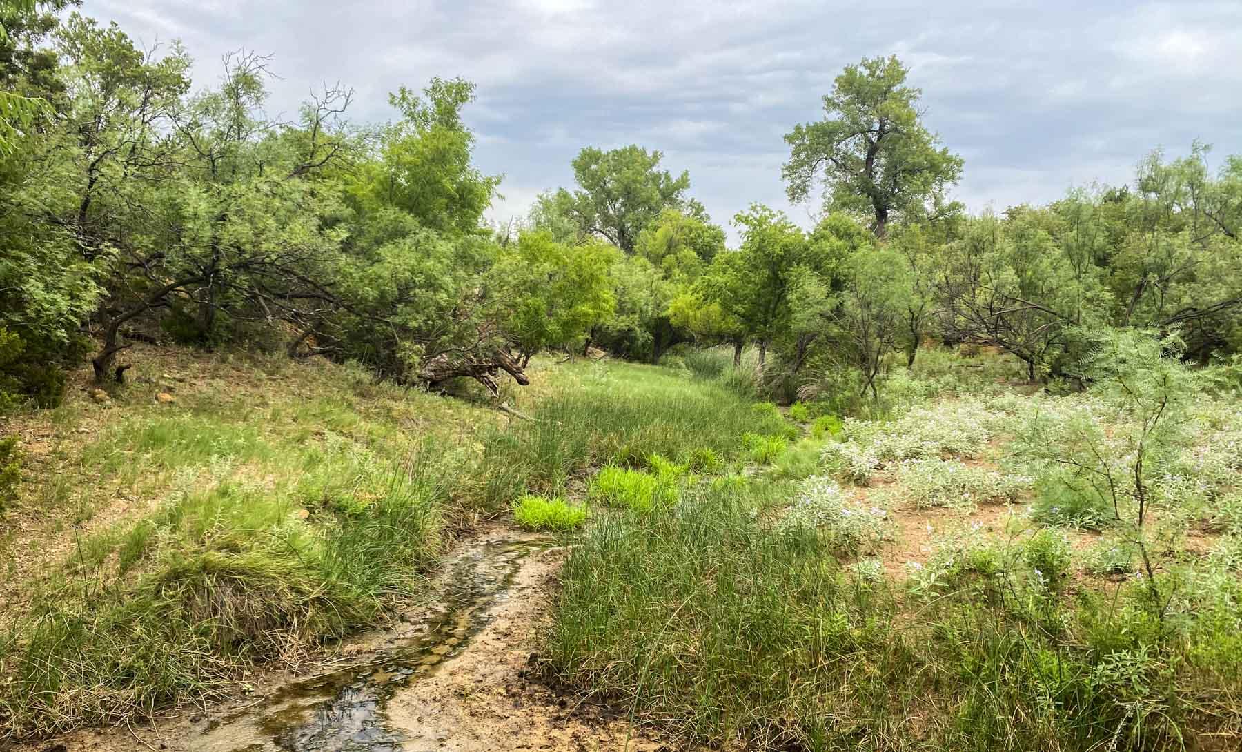
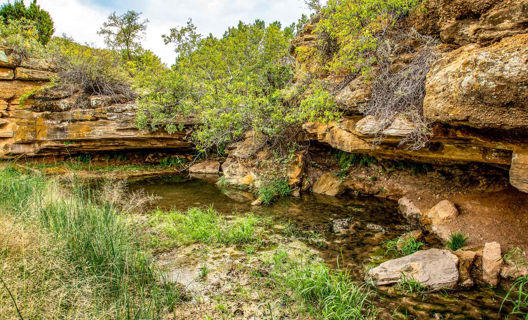
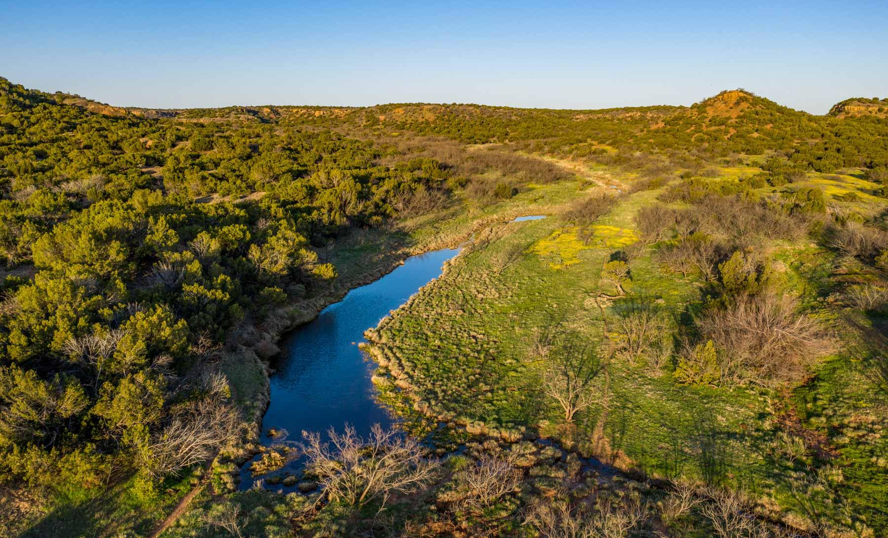
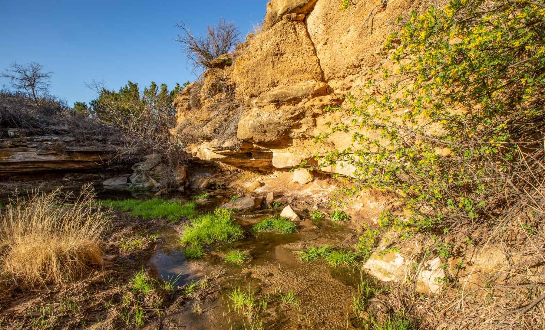
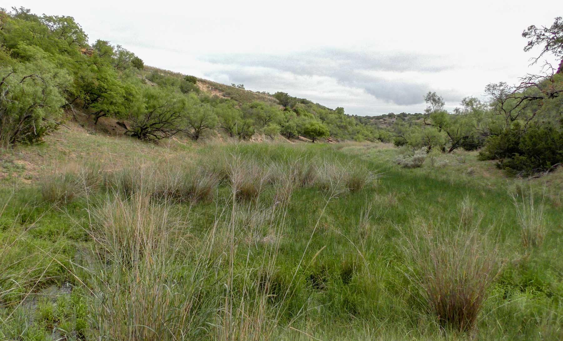
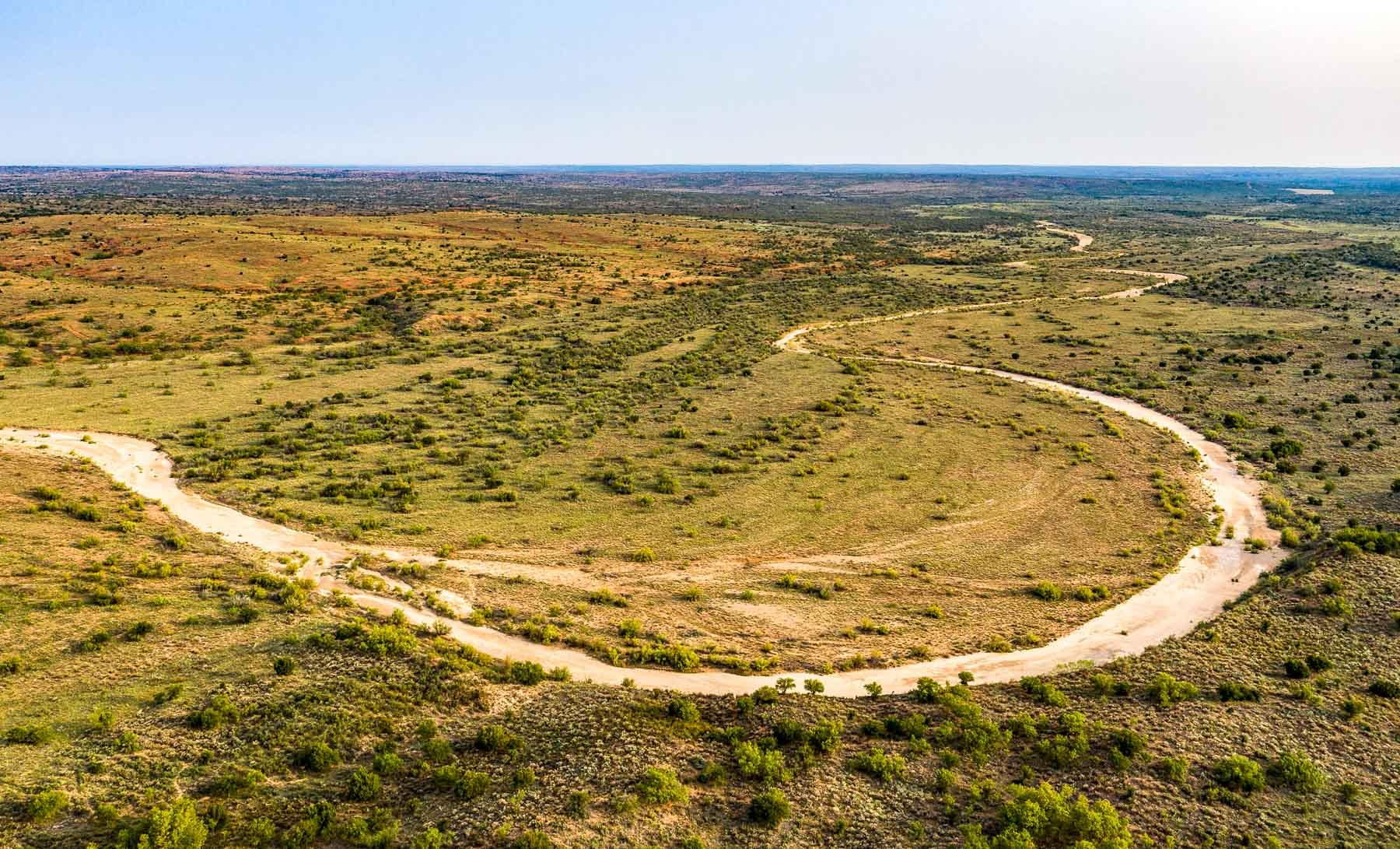
The property descends from the level upland plains country to the Rolling Plains under the Caprock edge. The terrain becomes broken below the Caprock with caliche, limestone and gravelly hills draining eastwardly. Juniper is scattered throughout this broken country, mostly on the ridgelines and steeper drainages. The major drainage below the Caprock is Wolf Creek, which heads just below the Caprock Escarpment and drains in a southeasterly direction through the ranch for a distance of approximately 7 – 8 miles. This live flowing spring fed creek exits the ranch near the southeast corner. The entire creek bottom is extremely scenic and very productive with much of the sandy bottom being subirrigated. Sand Sage and Plum thickets are common in the creek bottom. Cottonwood trees, Hackberry trees, Willows and Soapberry trees are scattered all along the creek bottoms. Elevation near the southeast corner of the ranch where Wolf Creek exits the property is approximately 2,600 feet. Away from the creek the property elevates with gravelly rolling hills, scattered bluffs and draws draining to the creek. This area of the ranch has a good turf of native grasses with a scattered to moderate canopy of Mesquite, Shin Oak, Hackberry and Juniper in the rougher areas.
Further to the east, sandstone ridges are common above the creek with rolling sandy loam soils over a large area of this portion of the ranch. Mesquite canopies are scattered to moderate with Sage and Shin Oak in the sandier areas.
A commercial gravel pit is located just south of the state highway and from time to time gravel mined from this pit generates additional cash flow to the ranch.
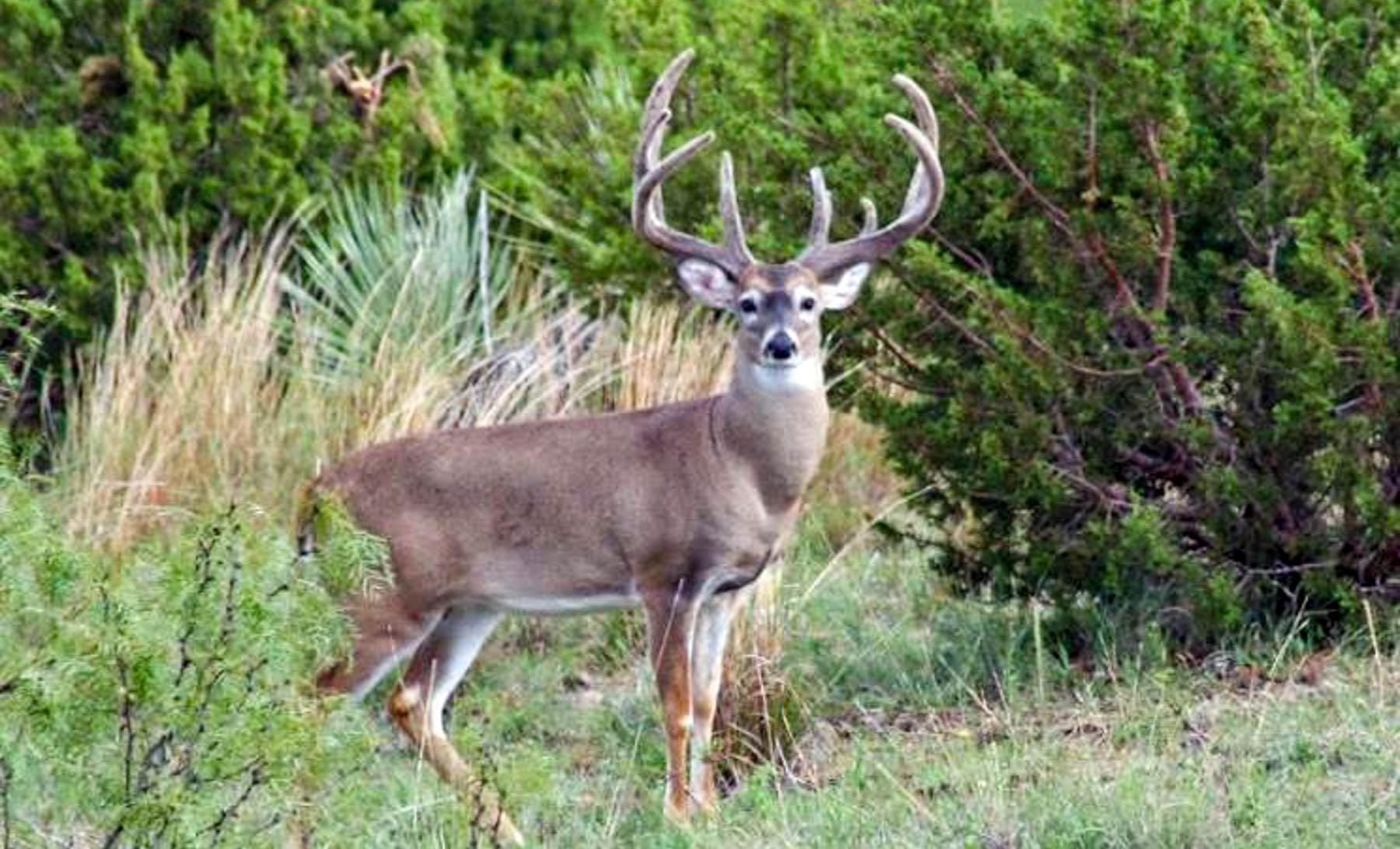
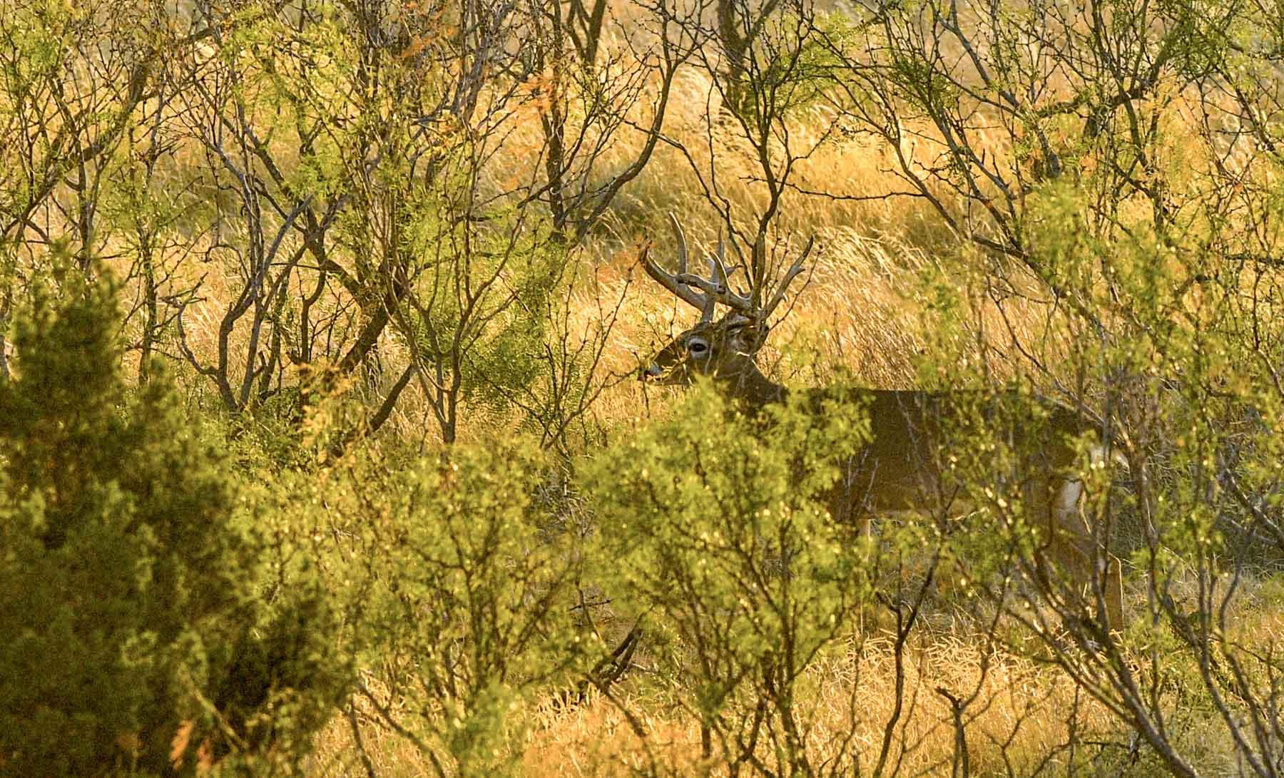
A paved state highway adjoins the north boundary of the Wolf Creek Division. The plains country is partitioned into 8 – 10 pastures and the country below the Caprock is partitioned into approximately 6 pastures and several traps. Approximately 1,000 acres are high game fenced. To accommodate hunters with a desire for even more superior deer than the natural genetics of the Rolling Plains, the ranch introduced superior whitetail deer in this high game fence area.
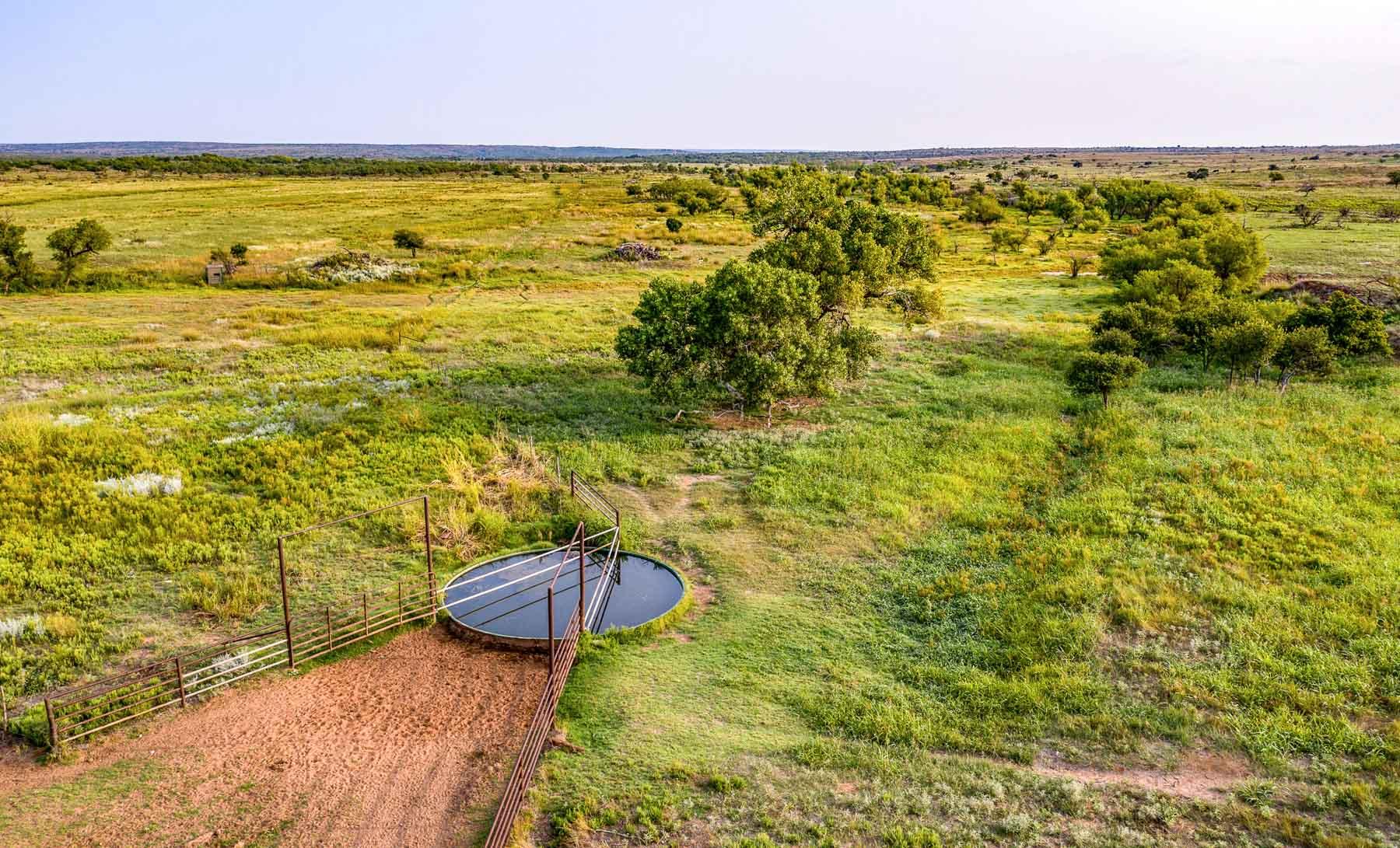
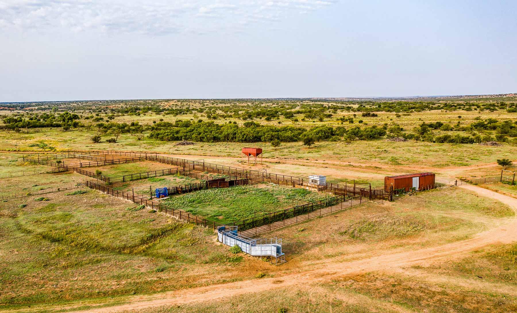
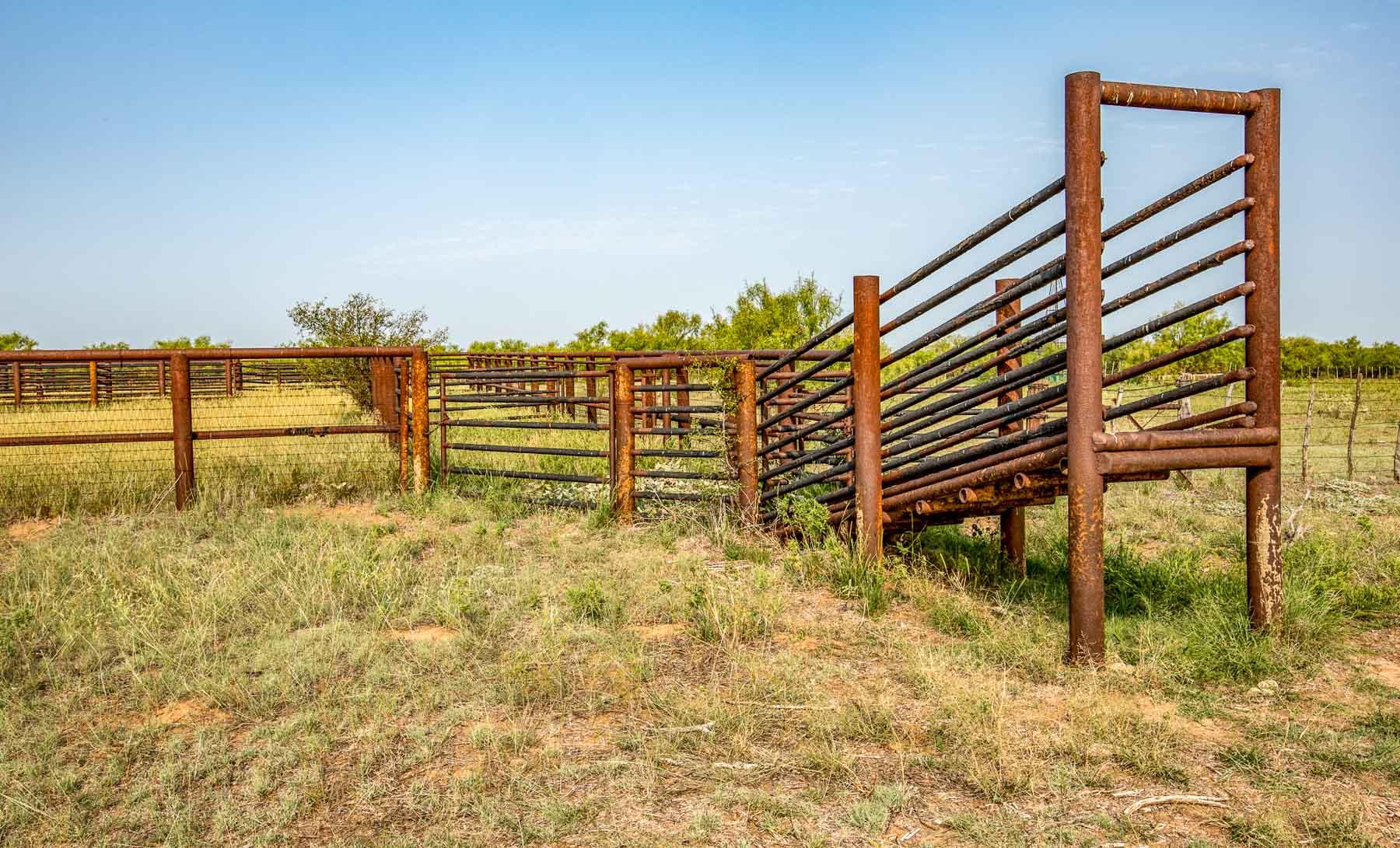
The Wolf Creek Division is improved by two large sets of shipping pens with scales and hydraulic chute. This Division is well watered by live creek water, pitted playa lakes, dirt tanks, wells and an extensive waterline network with drinking troughs.
The Wolf Creek Camp House, barn and pens are located on the highway on a separate 160-acre tract. The manager of the Wolf Creek Division resides at this camp house.
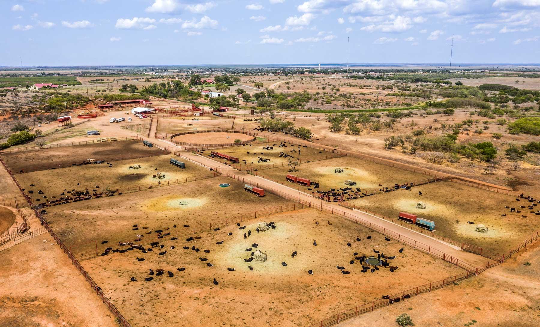
The Headquarters Division
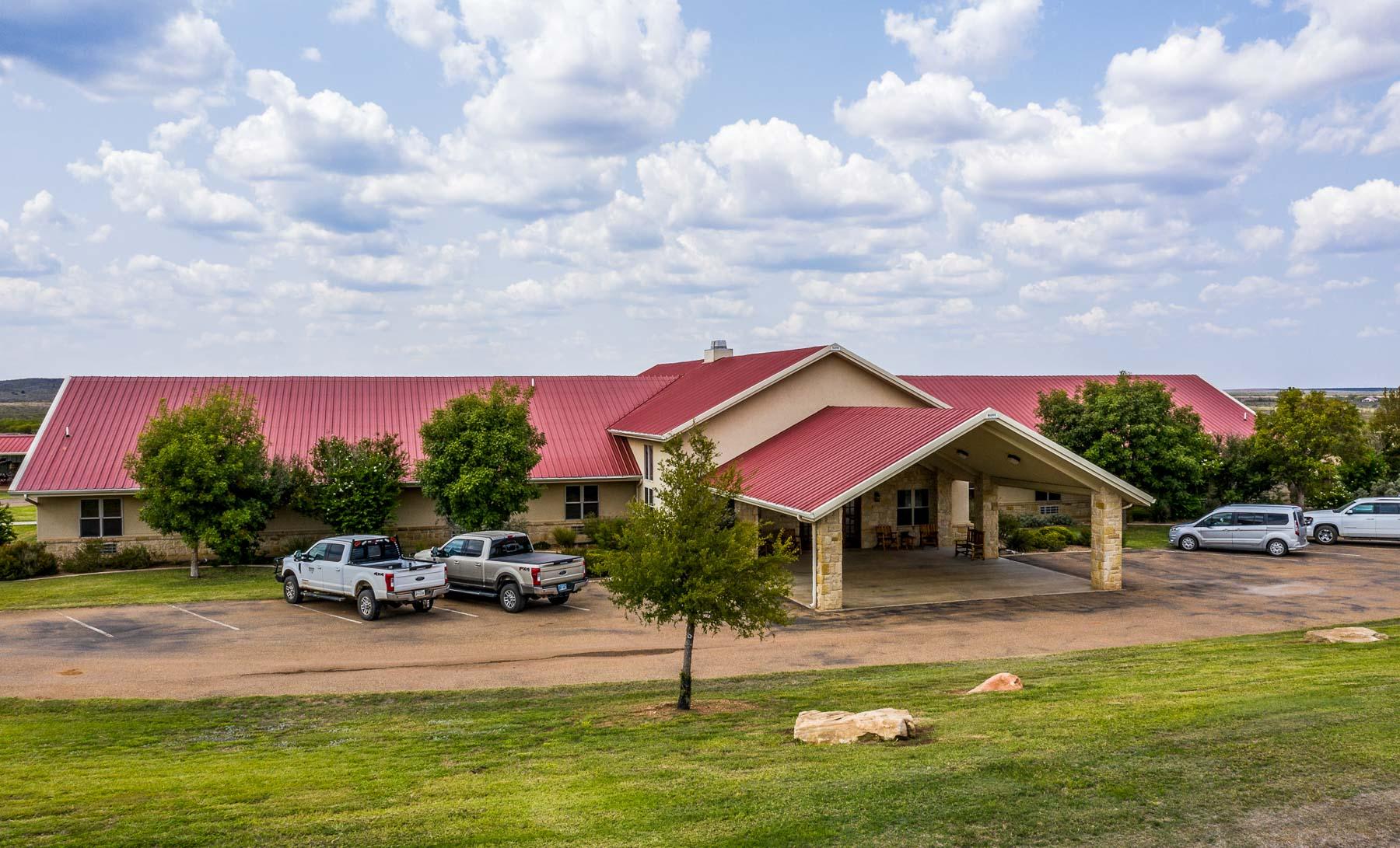
The Headquarters Division is immediately northeast of the Wolf Creek Division and this portion of the ranch is located just west and south of the Matador community. The Headquarters Division contains approximately 36,429 acres. This portion of the ranch has substantial highway frontage and also includes the historic Matador Headquarters stone house/office, cook house and main ranch shipping pens. In addition to the main rock house, there are several employee houses on this Division. In recent years, the Matador Lodge was constructed and added to the Headquarters Division. The primary use of this lodge is to house commercial hunters, but it is also used for corporate meetings, weddings, family reunions and other similar functions. The lodge is well constructed and features a large commercial kitchen, large great room with fireplace, eating area and 12 guest rooms with each room having full bath facilities. There is also a store in the lodge where the ranch markets “Matador” caps, shirts, vests, and other Matador items for customers to purchase. Just outside of the lodge is a covered barbecue pavilion with large fire pit, perfect for outdoor cooking.
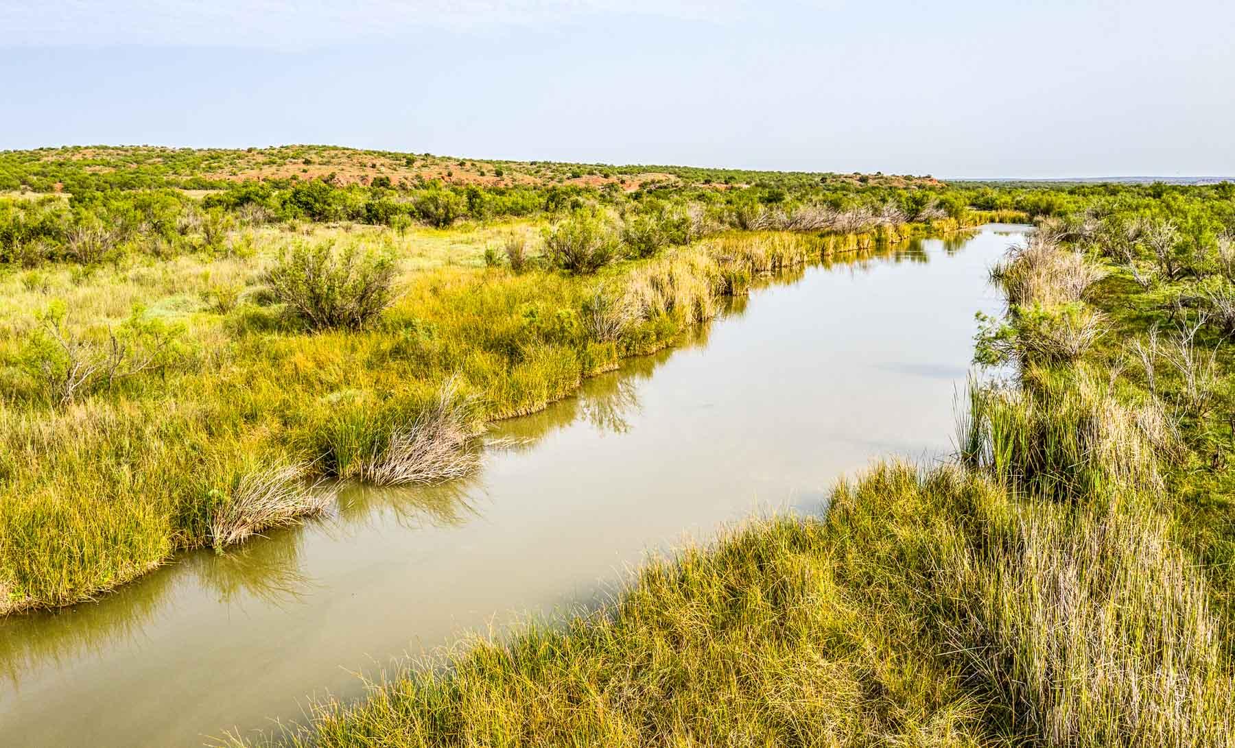
The topography of the Headquarters Division is generally rolling and hilly, complemented by several elevated ridges overlooking creek and river bottom areas. Dutchman Creek runs through the southern portion of the Headquarters Division and the Middle Pease River meanders through the north end of the ranch. Seasonal holes of water can be found in Dutchman Creek and live water is found along the Pease, depending on the season. Plum thickets are common. Salt Creek is located south of the Pease and this area has a high-water table with surface water present at times. Cottonwood, Soapberry, Hackberry and Willows are scattered throughout the lower creek bottom areas. The historic Ballard Springs are found near the Headquarters compound and a mile or so to the west Hackberry Springs flows a strong volume of live water. Elevations on the Headquarters Division range from 2,600 to 2,800 feet.
The more broken portions of this section of the ranch have sandstone rock outcrops and gravelly hillsides. Juniper is found in the rougher areas. The majority of the country has sandy and sandy loam soils with Mesquite, Sage and Shin Oak scattered throughout. All of the Headquarters Division is in native pasture with the exception of several hundred acres of improved Love Grass fields.
The Headquarters Division is fenced into five main pastures north of the highway and approximately 15 pastures and traps to the south. There are numerous working/branding pens and main shipping pens equipped with scales and hydraulic chutes. The Headquarters Division is watered by wells, an extensive waterline network with drinking troughs, dirt tanks and live spring and creek water.
The Russellville Division
This Division of the Matador Ranch contains approximately 31,962 acres and is located southeast of Matador. Access to this portion of the property is by paved highways and graded county roads. The Russellville Camp is located in the south-central portion of this Division. These camp improvements consist of the Russellville Manager’s Home, outbuildings and a very large set of shipping pens equipped with scales and hydraulic chute.
The west portion of this Division is described as fairly level and gently rolling country with deep productive soils. This area has a solid turf of native grasses. There were several small cultivated fields on this portion of the ranch and they are now seeded to improved grasses. This portion of the ranch has varying concentrations of Mesquite. Much of the neighboring land around this portion of the ranch is in cultivation, being farmed in cotton and wheat.
To the east, the country becomes more sloping with pronounced drainages. Mesquite is scattered through this portion of the ranch, as is Sand Sage and Shin Oak. Towards the center of this Division the terrain becomes more broken, finally transitioning to rough breaks, canyons and ridgelines on the far east side of the property. Juniper is more prevalent in this area of the ranch.
The western and northern portions of the Russellville Division generally have clay loam and sandy loam soils. The more broken canyon country on the southeast portion of the ranch has red clay soils.
The property is fenced and cross-fenced into approximately 25 pastures and traps. Water is furnished by wells and an extensive waterline network with numerous drinking troughs and dirt tanks. Even though portions of the Russellville Division are considered to be rough and broken, the waterline network is extended throughout major portions of this area of the ranch making the property very well-watered. Elevations range from approximately 2,000 to 2,800 feet.
The Tee Pee City/Lucky Knob Division
This Division of the ranch contains approximately 41,077 acres, making it the largest division of the Matador Ranch. This unit is located northeast of Matador, approximately five miles northeast of the Russellville Division. Access to the property is by paved highway on the west and graded county road on the south.
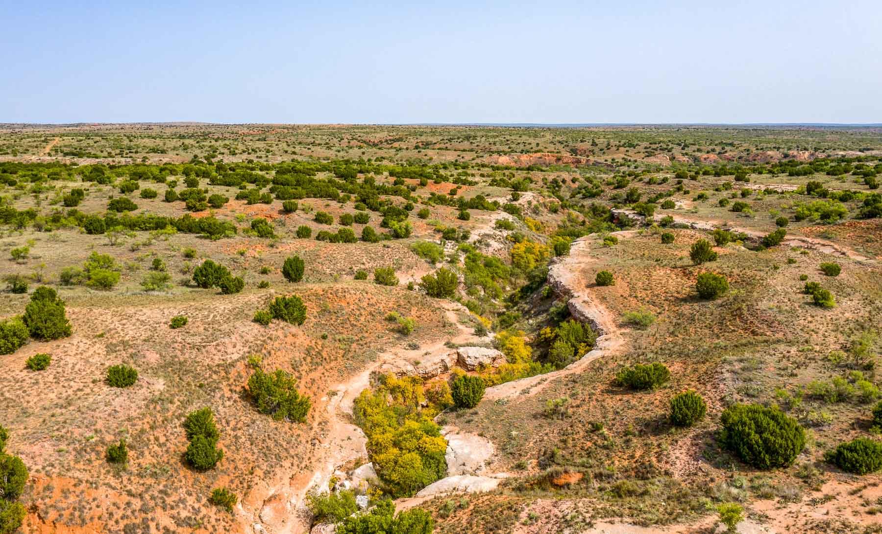
The Middle Pease River enters the ranch on the west side and meanders through a major portion of the property for a distance of approximately 10 miles, exiting the ranch on the northeast side. West of the river the elevated upland areas of the ranch are mostly loamy and clay loam soils with sandy bottomland in the draws and major drainage areas. An extremely steep, rugged and deep narrow canyon known as the “Ditch” enters the west central side of the ranch, running in an easterly direction and merging with the Pease River in the center of the property. In places this deep ditch serves as a natural barrier and can only be crossed by vehicle in a couple of places. This rugged area of the ranch is very scenic. West of the Pease the ranch has a moderate canopy of Mesquite with Juniper found in the rougher country.
Elevations on the ranch range from 1,800 to 2,300 feet.
The Pease River bottom is wide and productive with sandy soils and sub-irrigated vegetation along the river channel. Mesquite, Salt Cedar, Willows and Cottonwoods are all common in the river bottom. East of the river, soils are sandy loam and loamy with Mesquite, Sage and Shin Oak.
The property is fenced and cross-fenced into approximately 25 pastures and traps. A small in-holding tract is located near the north center of the ranch. Owners of this in-holding have historic access through the Matador to enter this in-holding tract.
The Tee Pee City/Lucky Knob Division is watered by the Pease River, dirt tanks, wells and waterlines with drinking troughs.
Improvements include working pens, two sets of shipping pens and the ranch manager’s house with outbuildings.
Summary
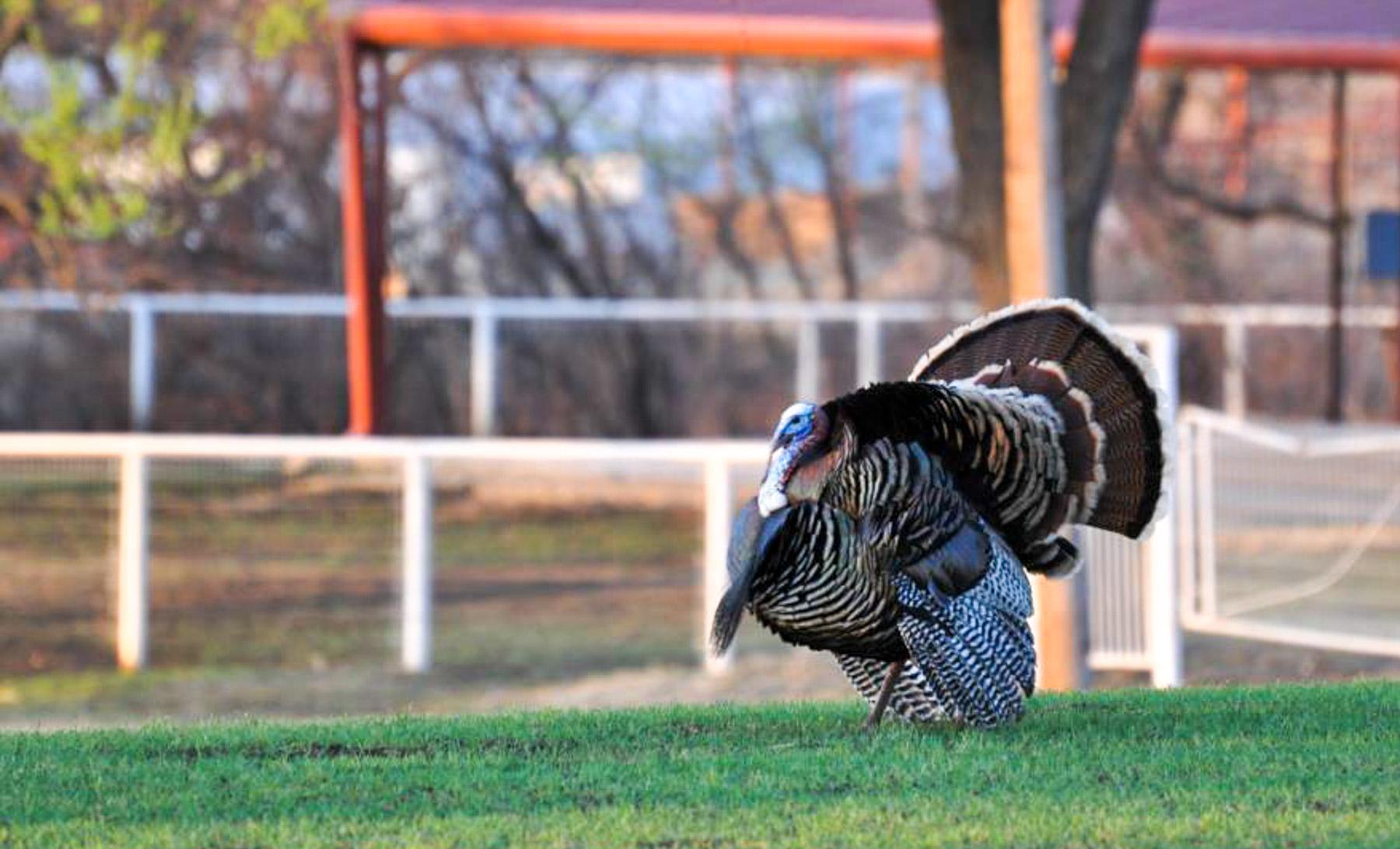
With its long history and nearly 70-year current ownership of the Matador Ranch, this is a rare opportunity to purchase this fine working cattle ranch. The property has been well improved, well managed and has the added benefit of great recreation and hunting opportunities.
The Matador Ranch is very realistically priced at $950 per acre and one-half of the Seller’s mineral interest will convey. The offering of the Matador Ranch is an opportunity to own and enjoy one of the most historic ranches not only in Texas, but in the United States.
Sam Middleton
- sam@csmandson.com
- 817-304-0504
- View Bio and Listings
Property Summary
Activities & Amenities
Land Details
- Total Acres: 131,000.00